2117 Route 219 Hwy | Independence, MO 64057
This feature is unavailable at the moment.
We apologize, but the feature you are trying to access is currently unavailable. We are aware of this issue and our team is working hard to resolve the matter.
Please check back in a few minutes. We apologize for the inconvenience.
- LoopNet Team
thank you

Your email has been sent!
2117 Route 219 Hwy
Independence, MO 64057
Land For Sale · 5.18 AC

Executive Summary
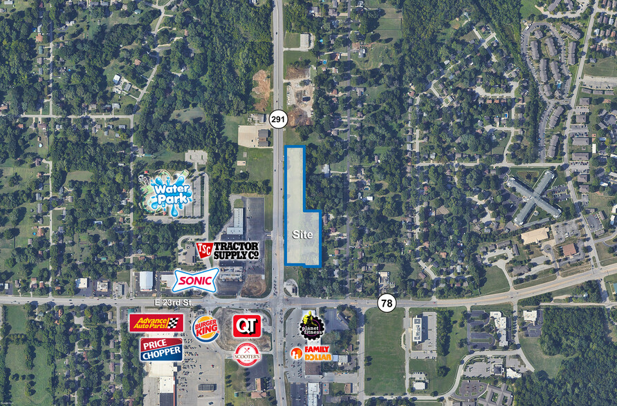
5.18 +/- acre development site.
Zoned Neighborhood Commercial District (C-1).
Located just north of high traffic count intersection.
Two potential curb cuts along frontage.
Utilities available.
Offered at $3.00 per square foot
Zoned Neighborhood Commercial District (C-1).
Located just north of high traffic count intersection.
Two potential curb cuts along frontage.
Utilities available.
Offered at $3.00 per square foot
PROPERTY FACTS
| Sale Type | Investment | Property Subtype | Commercial |
| No. Lots | 1 | Proposed Use | Commercial |
| Property Type | Land | Total Lot Size | 5.18 AC |
| Sale Type | Investment |
| No. Lots | 1 |
| Property Type | Land |
| Property Subtype | Commercial |
| Proposed Use | Commercial |
| Total Lot Size | 5.18 AC |
1 Lot Available
Lot
| Price | £528,154 | Lot Size | 5.18 AC |
| Price Per AC | £101,960 |
| Price | £528,154 |
| Price Per AC | £101,960 |
| Lot Size | 5.18 AC |
5.18 +/- acre development site. Zoned Neighborhood Commercial District (C-1). Located just north of high traffic count intersection. Two potential curb cuts along frontage. Utilities available. Offered at $3.00 per square foot
PROPERTY TAXES
| Parcel Number | 25-420-02-44-00-0-00-000 | Improvements Assessment | £0 |
| Land Assessment | £112,673 | Total Assessment | £112,673 |
PROPERTY TAXES
Parcel Number
25-420-02-44-00-0-00-000
Land Assessment
£112,673
Improvements Assessment
£0
Total Assessment
£112,673
zoning
| Zoning Code | C-2 (General Commercial) |
| C-2 (General Commercial) |
1 of 2
VIDEOS
3D TOUR
PHOTOS
STREET VIEW
STREET
MAP

