Carnbane Way 8.3 Acres of Commercial Land in Newry BT34 1LH
INVESTMENT HIGHLIGHTS
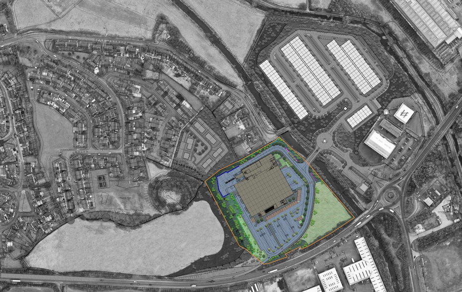
- Site extending to about 8.3 acres (3.36 ha)
- Full planning permission for foodstore extending to 8,650 sq. m with carparking
- Zoned Local Landscape Policy Area in the Banbridge/Newry & Mourne Area Plan 2015
EXECUTIVE SUMMARY
PROPERTY FACTS
| Sale Type | Investment |
| Tenure | Freehold |
| No. Lots | 1 |
| Property Type | Land |
| Property Subtype | Commercial |
| Total Lot Size | 8.30 AC |
1 LOT AVAILABLE
Lot
| Lot Size | 8.30 AC |
Site extending to about 8.3 acres (3.36 ha).
DESCRIPTION
The subject property comprises prime development lands extending to a total site area of 8.3 acres (3.36 ha). The site is located within the development limit of Newry and is zoned as a Local Landscape Policy Area in the Banbridge/Newry & Mourne Area Plan 2015 (Ref: NY 114). The site is rectangular in shape and the topography is gently undulating, ranging in elevation from about 11meters above sea level to the north, to about 30 meters above sea level to the south. The site benefits from excellent road frontage and is currently accessed off the A28 at the north of the site, with provision for further access onto the Carnbane roundabout. It is bounded by the Newry river to the west, settled housing to the south, and a proposed residential development site to the east.