This feature is unavailable at the moment.
We apologize, but the feature you are trying to access is currently unavailable. We are aware of this issue and our team is working hard to resolve the matter.
Please check back in a few minutes. We apologize for the inconvenience.
- LoopNet Team
thank you

Your email has been sent!
State Route 15 - State Route 15
5.8 Acres of Commercial Land Offered at £7,366 in Carey, OH 43316


Executive Summary
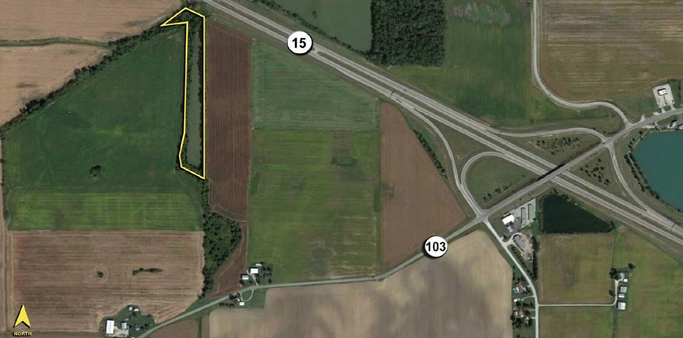
- Deep, but narrow property with 50’± frontage on State Route 15 that lies parallel and follows Spring Run Creek.
- Depth of the parcel is 1,400’± with the width of the site varying from 100’ – 200’.
- The rear boundary line forms a point that terminates at a bend in the creek.
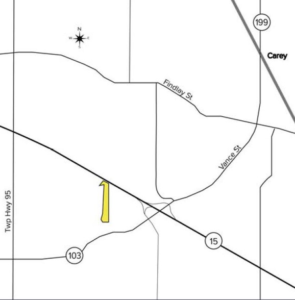
- Village of Carey is located to the north. City of Findlay is located to the northwest.
- Site is located in a flood plain (Flood Zone A), per Wyandot County, Ohio Community Panel #3907870025C, dated 9/18/87.
Property Facts
| Price | £7,366 | Property Subtype | Commercial |
| Sale Type | Investment | Proposed Use | Commercial |
| No. Lots | 1 | Total Lot Size | 5.80 AC |
| Property Type | Land |
| Price | £7,366 |
| Sale Type | Investment |
| No. Lots | 1 |
| Property Type | Land |
| Property Subtype | Commercial |
| Proposed Use | Commercial |
| Total Lot Size | 5.80 AC |
1 Lot Available
Lot
| Price | £7,366 | Lot Size | 5.80 AC |
| Price Per AC | £1,270 |
| Price | £7,366 |
| Price Per AC | £1,270 |
| Lot Size | 5.80 AC |
- Located on the south side of State Route 15/US-23, ½ mile west of intersection with State Route 103. - Deep, but narrow property with 50’± frontage on State Route 15 that lies parallel and follows Spring Run Creek. - Depth of the parcel is 1,400’±
Description
? Located on the south side of State Route 15/US-23, ½ mile west of intersection with State Route 103. ? Deep, but narrow property with 50’± frontage on State Route 15 that lies parallel and follows Spring Run Creek. ? Depth of the parcel is 1,400’± with the width of the site varying from 100’ – 200’. ? The rear boundary line forms a point that terminates at a bend in the creek. ? Village of Carey is located to the north. City of Findlay is located to the northwest. ? Site is located in a flood plain (Flood Zone A), per Wyandot County, Ohio Community Panel #3907870025C, dated 9/18/87.
PROPERTY TAXES
| Parcel Number | 09-124000.0000 | Improvements Assessment | £0 |
| Land Assessment | £7,739 | Total Assessment | £7,739 |
PROPERTY TAXES
zoning
| Zoning Code | Agricultural |
| Agricultural |
Amenities
- Utilities
Presented by

State Route 15 - State Route 15
Hmm, there seems to have been an error sending your message. Please try again.
Thanks! Your message was sent.


